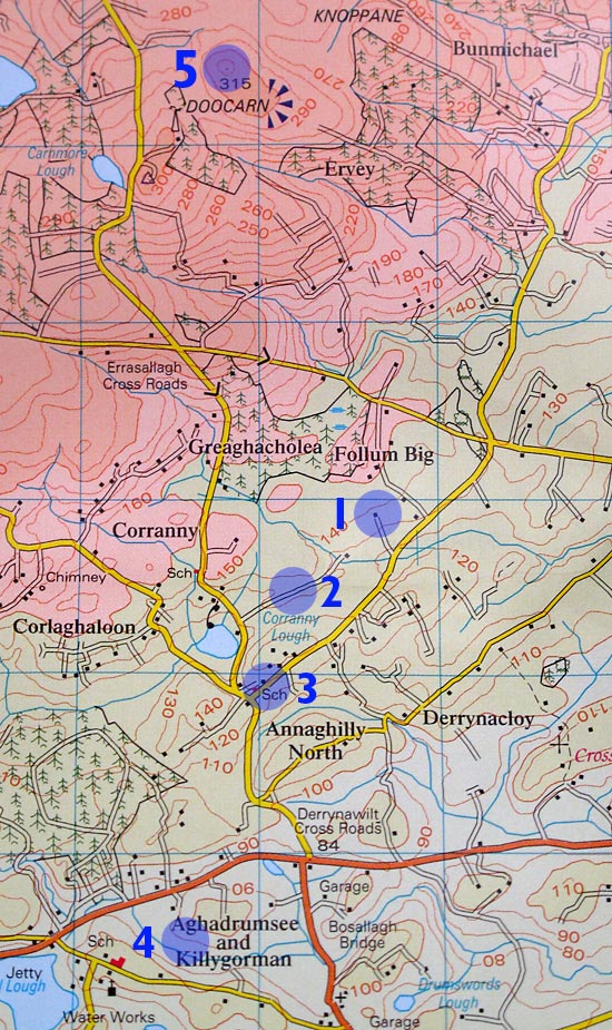
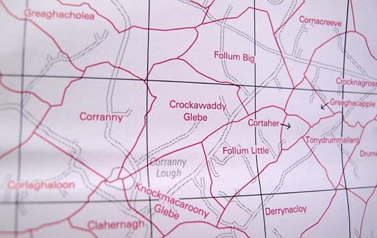
Crockawaddy Glebe is west of Rosslea, north of Aghadrumsee in County Fermanagh, west of Belfast, Northern Ireland. “Crockawaddy” is the name of the Townland (a unit of 50-70 acres), and “Glebe” indicates that they had to pay rent to the Protestant Church of Ireland.
#1 – The farmhouse at Crockawaddy Glebe (the small, black square in the middle of the circle)
#2 – Corr’s Lane, the “Road to America”. Corr’s house is at the top end of this lane and there used to be a road connecting it with Crockawaddy.
#3 – The Schoolhouse of Corranny Primary, where cousin Tom went to School
#4 – The small town of Aghadrumsee
#5 – The Carnmore Viewpoint
For those (family members) wanting a detailed map of this area, look for the “Ordnance Survey of Northern Ireland, Discoverer Series: Upper Lough Erne, Sheet 27”. © Crown Copyright 2008. http://www.osni.gov.uk/mapstore.htm. The scale is 1:50,000, with Townland Map on Reverse. These can be purchased at “News Agents” and bookstores in the area. (Thanks to my childhood friend, Eva, for telling me about these maps.)

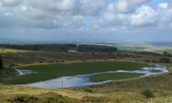
Here’s a view looking southwest from Carnmore View Point (#5) toward Carnmore Lough.


Thank you, cousin. I have been there. 🙂
My mother Ellen Bridget McCaughey was born in Crockawaddy on the 3 December 1916. I am hoping to visit the area in November 2024